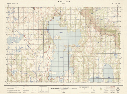
Great Lake 1954 - Historical Map
$75.00 AUD
(
/
)
Unavailable
GST included
Year: 1954
Print Size: 74cm x 55cm
Published at a scale of 1 mile to 1 inch (1:63 360), the map was produced with a contour interval of 50 feet. It portrays the extent of Great Lake prior to the lake level being raised by approximately 10 metres in the late 1960's.
Reproductions are inkjet printed on high quality paper using colour-fast UV tolerant inks, suitable for laminating or framing.
Please note that historical maps are printed on demand as orders are received which may cause an additional 2-3 day delay over and above standard delivery times.

