

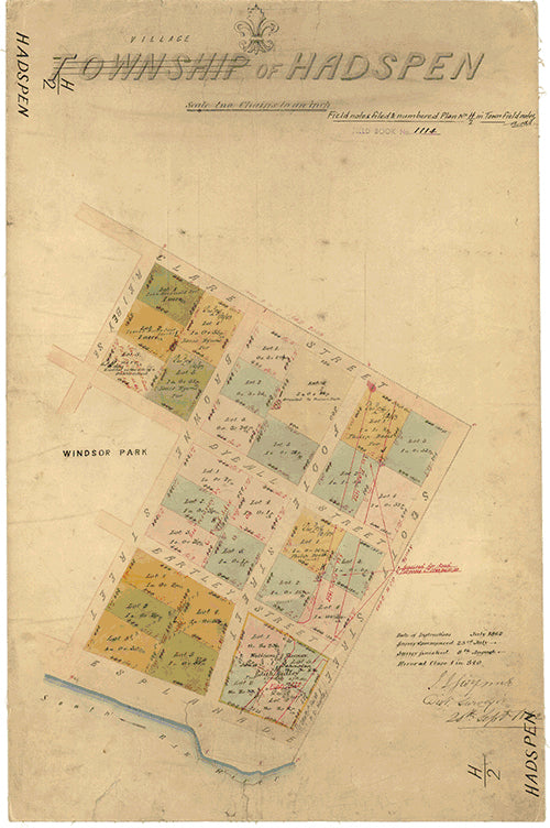
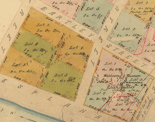
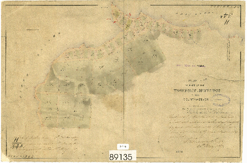
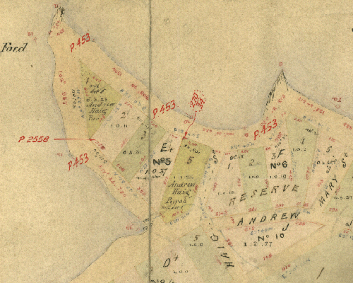
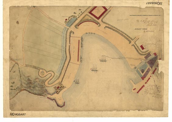
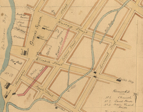
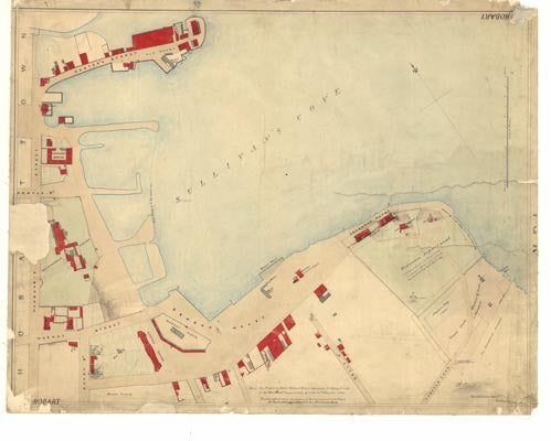
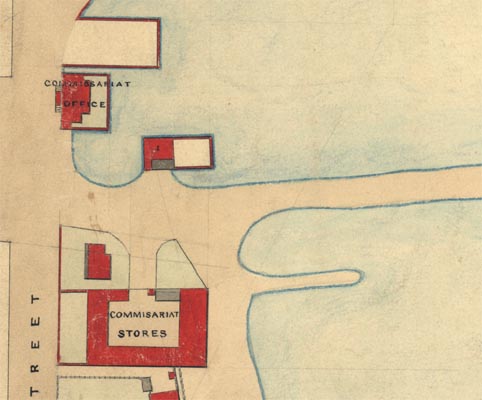
Reproductions of a selection of Tasmanian Historical Plans and Charts from the early 19th Century. They are inkjet printed on high quality paper using colour-fast UV tolerant inks. These plans and charts are suitable for laminating or framing.
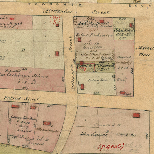
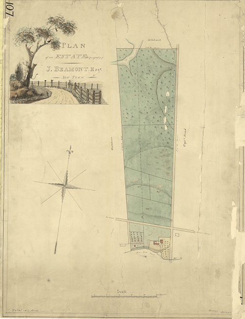
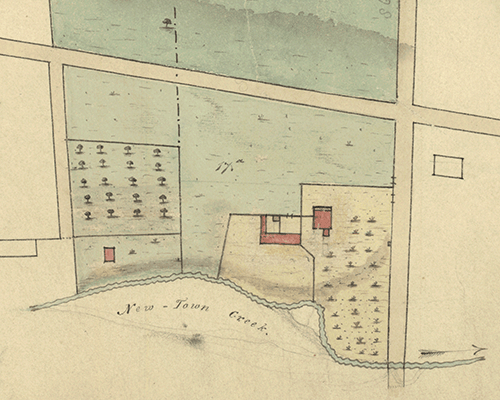
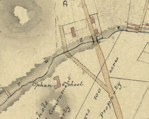
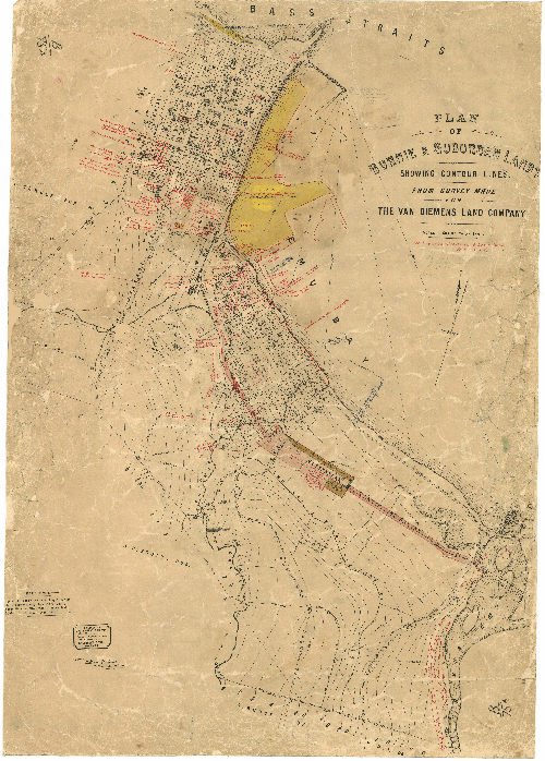
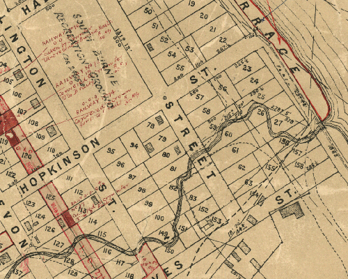
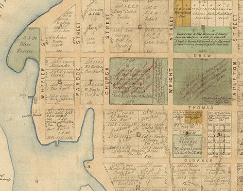
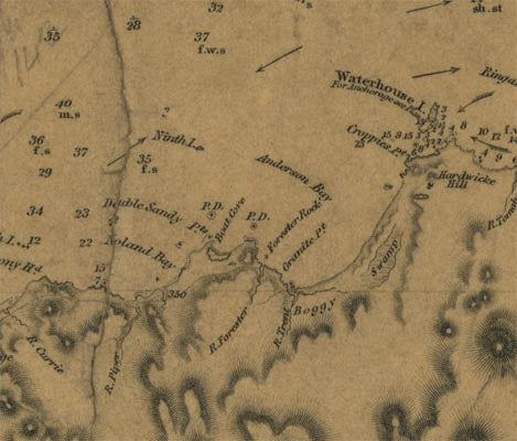
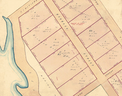
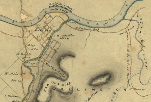
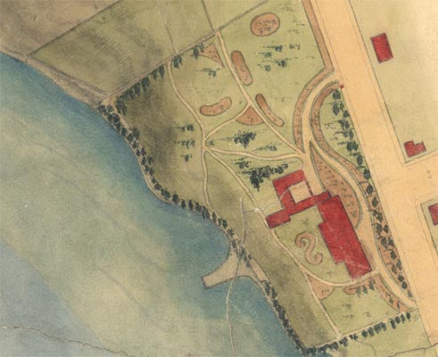
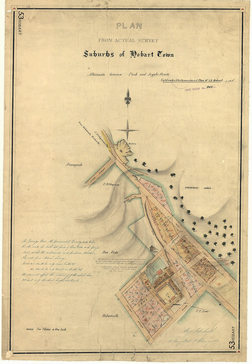
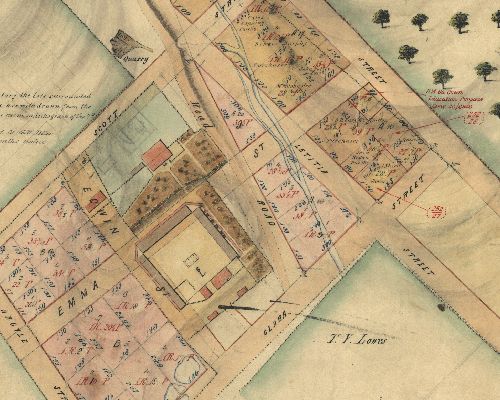
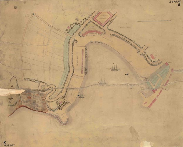
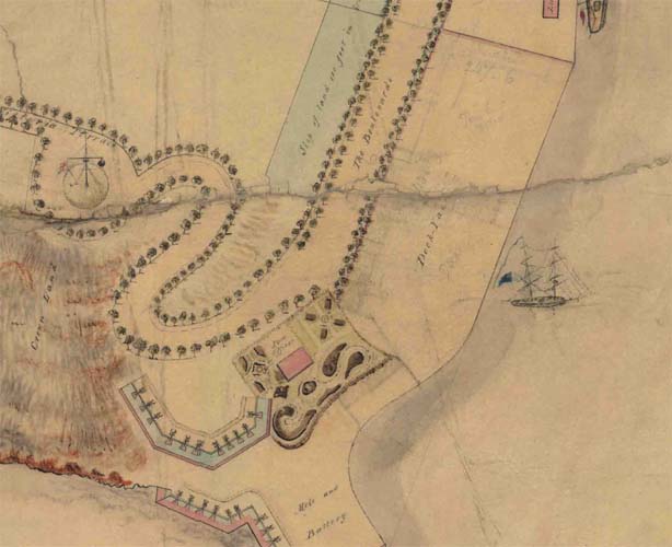
These historical documents have been used as a point of reference by generations of government employees, on a regular basis over many years, providing context for the evolution of land use and development in Tasmania. While the level of detail varies, many of the 200 year old plans and charts show the position of original residences and government buildings, vegetation, streets and waterways, names of property owners and occupants, sometimes even construction materials.
The high quality scans are available for sale and are ideal for framing or laminating.
-
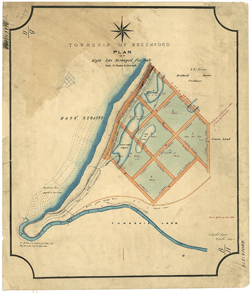
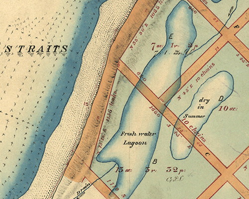
Beechford B11 - Historical Chart
$75.00 AUD( / )Unavailable -
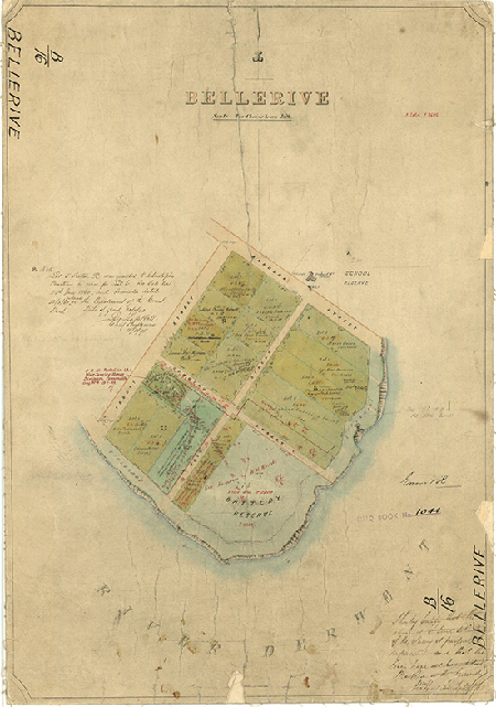
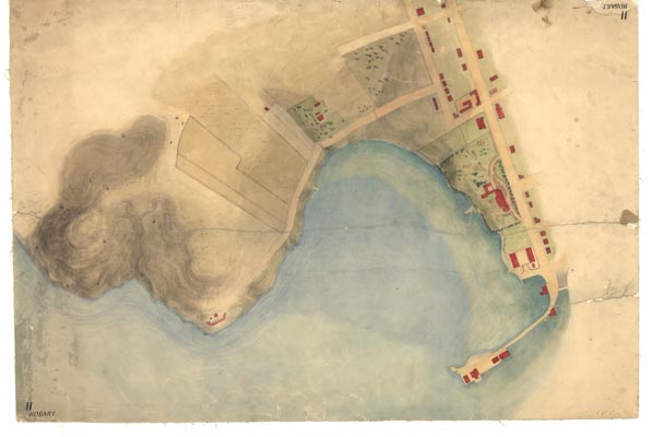
Bellerive B16 - Historical Chart
$75.00 AUD( / )Unavailable -

Bothwell 43 - Historical Chart
$75.00 AUD( / )Unavailable -
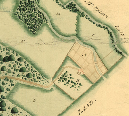
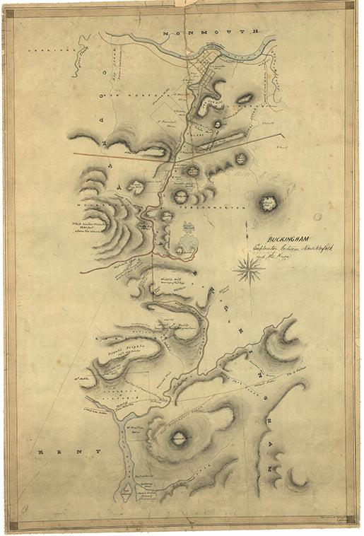
Buckingham 107 - Historical Chart
$75.00 AUD( / )Unavailable -
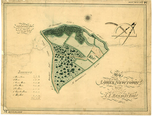
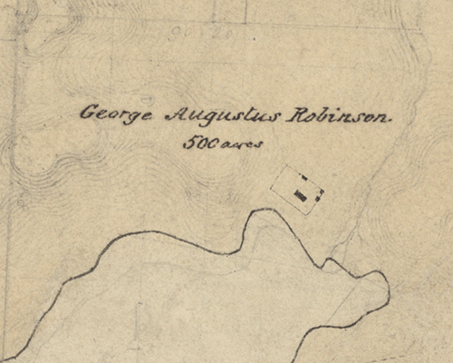
Buckingham 14 - Historical Chart
$75.00 AUD( / )Unavailable -
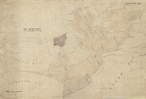
Buckingham 146 - Historical Chart
$75.00 AUD( / )Unavailable -
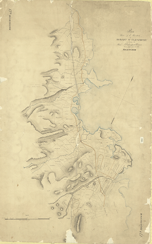
Buckingham 17A - Historical Chart
$75.00 AUD( / )Unavailable -
Burnie B75a - Historical Chart
$75.00 AUD( / )Unavailable -
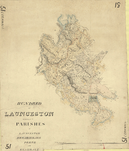
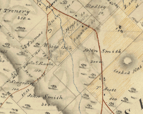
Cornwall 51 - Historical Chart
$45.00 AUD( / )Unavailable -
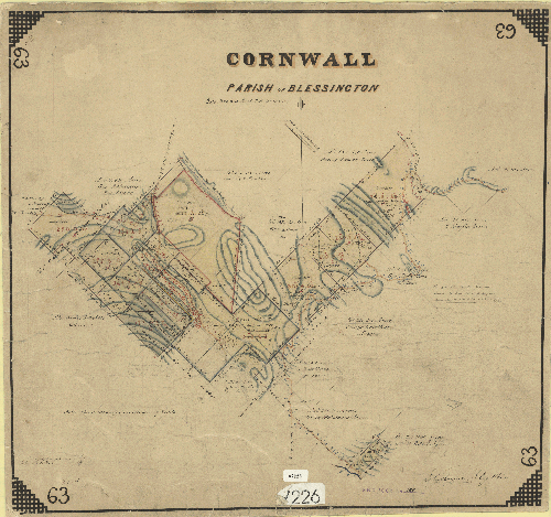
Cornwall 63 - Historical Chart
$75.00 AUD( / )Unavailable -
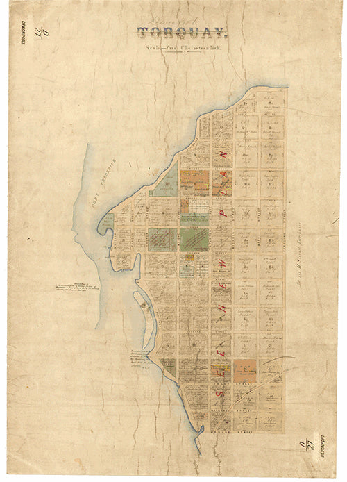
Devonport D27 (Torquay) - Historical Chart
$75.00 AUD( / )Unavailable -
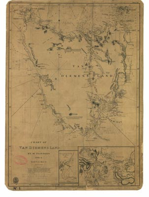
Flinders Chart 1798 - Historical Chart
$75.00 AUD( / )Unavailable -

George Town G5 - Historical Chart
$75.00 AUD( / )Unavailable -
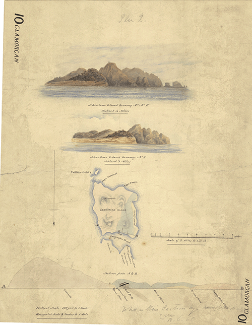
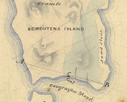
Glamorgan 10 - Historical Chart
$45.00 AUD( / )Unavailable -
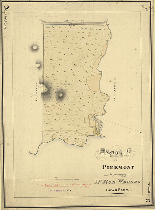
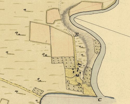
Glamorgan 9 - Historical Chart
$75.00 AUD( / )Unavailable -
 $75.00 AUD( / )Unavailable
 -
Heybridge 34A - Historical Chart
$75.00 AUD( / )Unavailable -
 $75.00 AUD( / )Unavailable
 -
 $75.00 AUD( / )Unavailable
 -
 $75.00 AUD( / )Unavailable
 -

 $45.00 AUD( / )Unavailable
 -
 $75.00 AUD( / )Unavailable
 -
 $75.00 AUD( / )Unavailable
 -
 $75.00 AUD( / )Unavailable


